Pages

Showing posts with label tourism. Show all posts

Wednesday, 30 May 2012

Los Santos to Jordán

On Sunday morning we got up early, but not early enough, as it turned out, to walk one of the Lengerke paths. It takes about an hour & a half to drive from Bucaramanga to Los Santos on the Mesa de los Santos and though the road is good, it has many curves. The mesa is a lush green plateau at about 1500m which gives it a fresh and pleasant feel. It's a favourite place for weekend trips from Bucaramanga and there are many holiday homes and cabins. Los Santos is a small town perched on the edge of the mesa overlooking the Chicamocha river way below.


We parked in the town square, which was very noisy & busy. Several shops were playing really loud music onto the street. A short walk through the town took us to the start of the Camino Real track which we'd planned to walk. Light clouds were covering parts of the town when we started out, but they quickly cleared allowing us to see our destination of the tiny town of Jordán Sube only 5km away but 850m below.


We started walking about 9.30 on what turned out to be a hot and, for much of it, still day. We had the worst of the heat and the sun especially on the way back. We passed a few walkers, and an old man with a mule carrying tobacco coming up who probably thought we were crazy to walk in the middle of the day and I was thinking at the time it might not be sensible, but didn't want to miss the walk. The first section was a little messy with lots of litter, and some mess from the mules that do use the track. It snakes down the steep canyon side all the way, with plenty of hairpins. There are no flat sections and some stretches are fairly steep, but not too bad. Most of the track is paved with small flat rocks & in good condition so the footing is good. At this time everything was very dry with no flowing water except for a small stone channel about half way down which was great to get water to cool off. There is some shade in places all along the route, but mostly it is fairly open scrub with lots of cactus. On the way we passed a couple of small fields of tobacco, a few cows and several mamoncillo trees which are a speciality of Jordán. After peeling the skin from the small green fruit you suck off the juicy flesh from the large stone.


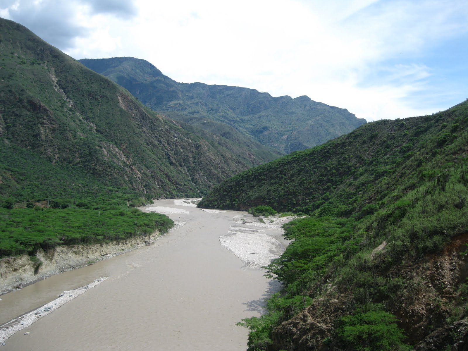
We took our time, which allowed me to do some birding and we reached Jordán just before mid-day. The sun was fierce, we were drenched with sweat and the heat sapped our strength. It was probably well over 30C in Jordán with no breeze. You enter the town by crossing a small suspension bridge (with a few holes) over the sediment packed Chicamocha river below. Sadly, the flow is pretty strong and a swim in the river might well be your last. Supposedly the bridge was built by some Irish engineers in 1870, but I've no idea what they were doing there in those days.


Jordán has the honour of being the smallest municipality in Santander and the town was almost deserted. Perhaps a baking-hot Sunday lunchtime is not the best time to visit but it is, no doubt, one of the quietest towns around because of its isolated location in the canyon. Many of the houses are abandoned, almost with the feel of a ghost-town and I heard it now has only around 70 inhabitants. However, the main square is picturesque and not unpleasant. The posada de caminantes (walker's hostel) was locked and there was no sign of life. So was the small church but the police station was open and manned. The local authorities are trying to revive the town and hoping for some developments from the Chicamocha National Park to bring in more tourists, but let's hope they can preserve the peaceful atmosphere.


Fortunately, we managed to find a couple of basic shops to stock up on water & drinks for the climb back up, as well as buy a few snacks for lunch. There wasn't much choice, but it was good enough. We used about 3 litres of water each, and the walk took us about 7 hours in total but we stopped frequently because of the heat. You do need to be reasonably fit, bring plenty of water, sun-cream, a hat and insect repellent for this walk. No need for a map though as there is only one trail! You can find the profile on the wikiloc link in my last post.

As well as the great views, there was plenty of wildlife to see; colourful butterflies galore, lots of lizards both large and small and many species of birds. Quite a number of these were new to me, but I'm struggling to identify them on first sight even when I've taken good field notes. There are just so many similar species you need to know the subtle differences to look for. Still, I'm learning more every day. Fairly easy to see and to identify was a magnificent Highland Motmot (Momotus aequatorialis), a megatick for me, looking something like a giant kingfisher with a fantastic tail. Sadly I didn't get a picture of it (google it!)..... maybe next time.

Overall a very enjoyable and interesting day despite the heat.

Tuesday, 29 May 2012

Senderos de Lengerke

Geo von Lengerke was a German who emigrated to Santander in 1852 which was then an independent state. From a wealthy family he bought large amounts of land and settled in Zapatoca which is a small colonial town about 30km southwest of Bucaramanga. The town is well worth a visit despite the long journey - the road is good in places but a very bumpy in others. The estates around his haciendas of Montebello and La Florita grew quinine, cocoa and tobacco. Quinine was supposed to make Santander and Lengerke rich, but the price collapsed and his fortune evaporated. 

View of the hills around Zapatoca
He had red, curly hair, which was very unusual in this region, and it still is. It was said that he lived somewhat like a feudal lord. He is rumored to have had many illegitimate children, and anyone with red hair, or blue eyes in Santander, and especially Zapatoca might still be suspected of being one of his descendants. Elena says she knows at least two such red-heads from Zapatoca, so perhaps there is some truth in it. No doubt there were other German colonists in the area at the time so perhaps the legend is due to his more recent fame. Although he died from alcoholism, he wasn't just a colonial playboy. He also met with the local indigenous tribes and produced a small book translating their languages. His life has been dramatized in a book & TV drama called “La otra raya del tigre” or “the tiger's other stripe”.  


Tomb of Geo von Lengerke in Zapatoca, Santander
Von Lengerke left a more solid legacy as a result of his attempts to develop the economy of the region by expanding a network of 700 km of stone pathways and bridges including from Zapatoca to Barrancabermeja on the Magdalena river. The wide paths were built very solidly and some parts of the network have survived. They were well engineered with stone channels to allow the water to run-off in the winter (wet-season). The trails are still sometimes used by locals to move produce by mule and are popular with walkers. The local tourist board are trying to use them as a means to attract more visitors.  


Colonial style courtyard in Zapatoca now a restaurant & museum.
The “Caminos Reales” (paths) which are supposed to be better preserved include:

Los Santos to Jordán Sube. About 5km each way. Descends steeply 850m from the Mesa de Los Santos to the tiny & nearly deserted town of Jordan on the Rio Chicamocha.


Barichara to Guane. About 7.5 km. Descends about 300m from the beautiful town of Barichara to the small pueblo of Guane. This one was declared a national monument.

Zapatoca to San Vincente de Chucurí. About 28 km climbing over the Serranía de los Yariguíes mountains through part of the national park with that name. The route has been restored (at least in part) as a 2 day trip.

Curití to Aratoca.

Around Galán.

We did the first walk on Monday and I'll post pictures of that shortly. We hope to try a few others with a local walking group soon.

These sites have more info in Spanish on some of the trails.

 http://unturporgaln.blogspot.com/2011/05/sus-senderos-y-caminos-reales.html


There are some GPS tracks on wikiloc for example:

http://es.wikiloc.com/wikiloc/view.do?id=1654879


Saturday, 14 April 2012

Panachi

The south of Santander has some exceptional destinations for tourism and we've had a few day trips and one overnighter. There is stunning mountain scenery, colonial architecture, interesting food and a host of outdoor adventure activities. The Chicamocha canyon is an attraction on a grand scale and together with the area around it provides a great place to visit. Here, the Chicamocha river has cut a deep canyon into the mountains and it makes a u-turn, winding around a place called Pescadero before joining the Sogomoso River. The canyon seems to have its own climate and is much drier than surrounding areas, so there's much more cactus and desert type scrub amongst the open rocks.


At Pescadero, the road from Bucaramanga to Bogotá climbs a series of hairpins before reaching Panachi – Parque Nacional del Chicamocha – and then goes on south to San Gil. The visitors centre perched on the mountain is well worth stopping for, even if the entrance fee seems high. The panoramic views are superb.


The enormous sculpture commemorating the “Revolt of comuneros” of Santander who started an uprising against tobacco taxation in 1781, is also very impressive. The sculpture represents a tobacco leaf, on which are posed various larger-than-life size figures with dramatic expressions making it a little disturbing when you stand amongst them.


There are a few attractions in Panachi for the adrenaline junkies – two long zip-wires, a couple of very large swings which take you out over the cliff edge, a zorb track and more attractions are being developed. There is also a cable car running across the canyon for a distance of about 6km to the Mesa de Los Santos. This 25 minute each-way trip is a great way to see the canyon closer-up.